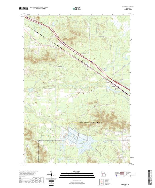
2022 Map of Millston
USGS Topo · Published 2022About this map
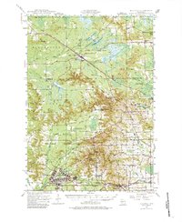
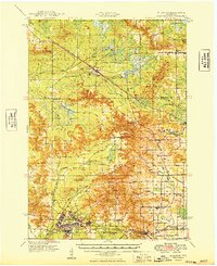
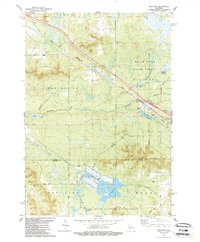
Millston serves as the central hub of this Jackson County region, where the intersection of Railroad St and local transit lines anchors the community. The landscape is defined by an intricate network of managed waterways and wetlands, including Sharptail Flowage to the northeast and the expansive North Flowage near the boundary of Monroe County. These water features, alongside Lee Lake and Glenn Pond, suggest a legacy of hydraulic management and cranberry cultivation or conservation efforts typical of the Wisconsin sand country. Local genealogy is anchored at Brookside Cem located just southeast of the main settlement. The terrain is further marked by a series of creeks, such as Robinson Cr and Stanton Cr, which meander through a grid of forest roads like Fire Tower Rd and Lambert Rd, illustrating the area's transition from timber and rail industries to modern rural utility.
Find a feature on this map
56 named features on this map. Tap any name to fly to it.
Don’t see what you’re looking for? This feature index may not catch every label — zoom into the map to look around manually.
Map Details
Editions of this 2022 Millston Map
This is the sole edition of this map. No revisions or reprints were ever made.
Historical Maps of Jackson County Through Time
4 maps found