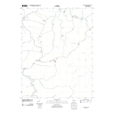
2011 Map of Millstone
USGS Topo · Published 2011About this map
Arnoldsburg and the rural communities of Millstone and Sand Ridge define the landscape of this southern Calhoun County region in the early 21st century. The map reveals a high density of family-named landmarks and cemeteries, reflecting the deep genealogical roots of West Virginia's central highlands. Numerous burial sites including Sylvester Stump Cemetery, Knotts Cemetery, and Zeke Run Cemetery are scattered across the drainage basins of Steer Creek and Sycamore Creek.
Find a feature on this map
73 named features on this map. Tap any name to fly to it.
Don’t see what you’re looking for? This feature index may not catch every label — zoom into the map to look around manually.
Map Details
Editions of this 2011 Millstone Map
This is the sole edition of this map. No revisions or reprints were ever made.
Other maps of this area

1893 · Sutton
USGS Topo · 1:125,000

1906 · Glenville
USGS Topo · 1:62,500

1906 · Otter
USGS Topo · 1:62,500

1907 · Otter
USGS Topo · 1:62,500

1907 · Arnoldsburg
USGS Topo · 1:62,500

1908 · Gassaway
USGS Topo · 1:48,000

1910 · Gassaway
USGS Topo · 1:62,500

1925 · Glenville
USGS Topo · 1:62,500

1925 · Arnoldsburg
USGS Topo · 1:62,500

1927 · Arnoldsburg
USGS Topo · 1:62,500