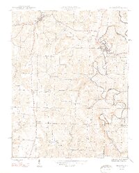
1948 Map of Milltown
USGS Topo · Published 1948About this map
Milltown sits at a sharp, winding bend of the Blue River along the border of Crawford and Harrison Counties. This mid-century survey illustrates a landscape where the Southern railroad connects the primary riverside settlements to inland crossroads like Marengo and the curiously named Hogtown. The terrain is defined by deep incisions from waterways like Whiskey Run and Slick Run, creating dramatic features such as The Narrows and Buzzard Roost Hill. For those researching local history, the map provides precise locations for several rural institutions that served the hill country, including Mt Zion Ch, St Joseph Ch, and Thompson Chapel. Higher elevations are marked by landmarks like White Oak Ridge and Pilot Knob, while the valley floors are dotted with small schools such as the Archibald Sch and Hottel Sch.
Find a feature on this map
38 named features on this map. Tap any name to fly to it.
Don’t see what you’re looking for? This feature index may not catch every label — zoom into the map to look around manually.
Map Details
Editions of this 1948 Milltown Map
2 editions found
Other maps of this area

1931 · Corydon
USGS Topo · 1:62,500

1944 · Corydon West
USGS Topo · 1:24,000

1946 · Leavenworth
USGS Topo · 1:24,000

1946 · Depauw
USGS Topo · 1:24,000

1947 · Leavenworth
USGS Topo · 1:24,000

1947 · Corydon West
USGS Topo · 1:24,000

1947 · Hardinsburg
USGS Topo · 1:24,000

1948 · Milltown
USGS Topo · 1:24,000

1949 · Hardinsburg
USGS Topo · 1:24,000

1950 · Beechwood
USGS Topo · 1:24,000