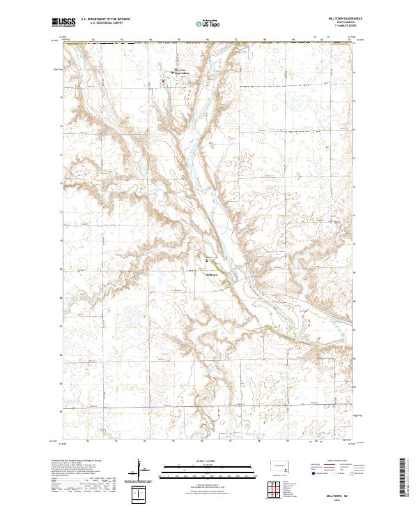
2021 Map of Milltown
USGS Topo · Published 2021About this map
Milltown stands at a bend in the James River in this survey of southeastern South Dakota, where the prairie landscape is defined by an intricate network of waterways. To the north, the New Elm Springs Colony represents a distinct communal settlement pattern typical of the region's Hutterite heritage. The topography is marked by the convergence of several drainages, including Twelvemile Cr, Pony Cr, and Plum Cr, which carve subtle valleys through the surrounding farmland. The settlement of Milltown itself is closely tied to the river's path, with the Milltown Cem situated just west of the main cluster of buildings. A strictly organized grid of section lines and county roads, such as 417th Ave and Keiper Rd, provides access to the agricultural tracts between the shifting courses of Dry Cr and its northern branch. This map documents a quiet rural area where water management and communal living have shaped the human geography.
Find a feature on this map
35 named features on this map. Tap any name to fly to it.
Don’t see what you’re looking for? This feature index may not catch every label — zoom into the map to look around manually.
Map Details
Editions of this 2021 Milltown Map
This is the sole edition of this map. No revisions or reprints were ever made.
Other maps of this area

1898 · Olivet
USGS Topo · 1:125,000

1899 · Alexandria
USGS Topo · 1:125,000

1955 · Sioux Falls
USGS Topo · 1:250,000

1957 · Tschetter Colony
USGS Topo · 1:24,000

1957 · Ethan
USGS Topo · 1:24,000

1957 · Milltown
USGS Topo · 1:24,000

1957 · Clayton
USGS Topo · 1:24,000

1957 · Rockport Colony
USGS Topo · 1:24,000

1958 · Sioux Falls
USGS Topo · 1:250,000

1973 · Spencer SW
USGS Topo · 1:24,000
Featured Places
- Milltown, SD
- Clayton Township, SD
- Wittenberg Township, SD
- New Elm Spring Hutterite Colony, SD
- Worthen Township, SD