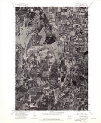
1974 Map of Milltown NW
USGS Topo · Published 1976About this map
Agricultural fields and dense woodlots define the landscape of Burnett County in the mid-1970s, as seen in this detailed orthophoto study. The rural settlement of Trade River serves as the primary landmark in a region characterized by a high-contrast mosaic of tilled acreage and natural vegetation. Unlike a standard topographic line drawing, this aerial imagery reveals the exact footprint of farms, the texture of forest canopies, and the precise boundaries of wetland pockets that dictate the local road network. The lack of heavy infrastructure or large-scale development reflects the enduring rural character of this corner of Wisconsin, where small-scale farming and timber management appear as the dominant land uses of the era.
Find a feature on this map
1 named feature on this map. Tap any name to fly to it.
Don’t see what you’re looking for? This feature index may not catch every label — zoom into the map to look around manually.
Map Details
Editions of this 1974 Milltown NW Map
This is the sole edition of this map. No revisions or reprints were ever made.
Other maps of this area

1950 · Rush City
USGS Topo · 1:48,000

1950 · Grantsburg
USGS Topo · 1:48,000

1951 · Milltown
USGS Topo · 1:48,000

1953 · Stillwater
USGS Topo · 1:250,000

1955 · Rush City
USGS Topo · 1:62,500

1955 · Milltown
USGS Topo · 1:62,500

1955 · Stillwater
USGS Topo · 1:250,000

1958 · Stillwater
USGS Topo · 1:250,000

1961 · Pine City
USGS Topo · 1:62,500

1962 · Grantsburg
USGS Topo · 1:62,500