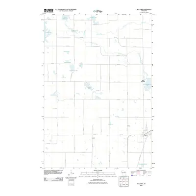
2010 Map of Milltown
USGS Topo · Published 2010About this map
Milltown serves as the primary hub in this portion of Polk County, where the village grid meets the southern reaches of a landscape defined by an intricate network of glacial lakes and wetlands. The community of West Denmark sits further north, situated near the shores of Little Butternut Lake. This 2010 survey illustrates the transition from organized town plats to the rural expanse of northwestern Wisconsin, where family and local history are preserved at sites like Evergreen Cemetery, Granum Cemetery, and Haustrup Cemetery. The northern terrain is carved by the Trade River and the meandering Butternut Creek, which connect larger water bodies such as Long Trade Lake and Bullhead Lake. For those tracing the evolution of regional infrastructure, the Gandy Dancer Trl provides a clear view of the recreational repurposing of former rail corridors, cutting through the countryside south of the village.
Find a feature on this map
36 named features on this map. Tap any name to fly to it.
Don’t see what you’re looking for? This feature index may not catch every label — zoom into the map to look around manually.
Map Details
Editions of this 2010 Milltown Map
This is the sole edition of this map. No revisions or reprints were ever made.
Other maps of this area

1900 · St Croix Dalles
USGS Topo · 1:62,500

1901 · St Croix Dalles
USGS Topo · 1:62,500

1950 · Balsam Lake
USGS Topo · 1:62,500

1951 · Milltown
USGS Topo · 1:48,000

1951 · Frederic
USGS Topo · 1:48,000

1953 · Stillwater
USGS Topo · 1:250,000

1955 · St. Croix Dalles
USGS Topo · 1:62,500

1955 · Frederic
USGS Topo · 1:62,500

1955 · Milltown
USGS Topo · 1:62,500

1955 · Stillwater
USGS Topo · 1:250,000