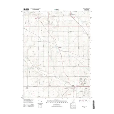
2013 Map of Millville
USGS Topo · Published 2013About this map
Indian Creek and Four Mile Creek define the drainage of this Butler County landscape, where small crossroads communities and rural homesteads sit among a dense network of country roads. The settlement at Millville serves as a southern anchor near Queen Acres, while the northern reaches of the map touch the outskirts of Oxford and the village of Darrtown. This area preserves a high density of burial grounds, including the centrally located Bethel Cem and the Milford Cem to the north, which provide valuable geographic markers for genealogical research in these townships. The presence of Hogan Airport and scattered water bodies like Island Pond and Holiday Lake highlight the mix of agricultural utility and local recreation. A complex web of routes, from Reily Millville Rd to Stillwell Beckett Rd, connects the various hamlets like Auburn, McGonigle, and Bunker Hill.
Find a feature on this map
113 named features on this map. Tap any name to fly to it.
Don’t see what you’re looking for? This feature index may not catch every label — zoom into the map to look around manually.
Map Details
Editions of this 2013 Millville Map
This is the sole edition of this map. No revisions or reprints were ever made.
Other maps of this area

1911 · Oxford
USGS Topo · 1:62,500

1915 · College Corner
USGS Topo · 1:48,000

1915 · Harrison
USGS Topo · 1:48,000

1915 · Hamilton
USGS Topo · 1:62,500

1917 · Hamilton
USGS Topo · 1:62,500

1918 · College Corner
USGS Topo · 1:62,500

1953 · Cincinnati
USGS Topo · 1:250,000

1955 · Harrison
USGS Topo · 1:24,000

1955 · Hamilton
USGS Topo · 1:24,000

1955 · Reily
USGS Topo · 1:24,000