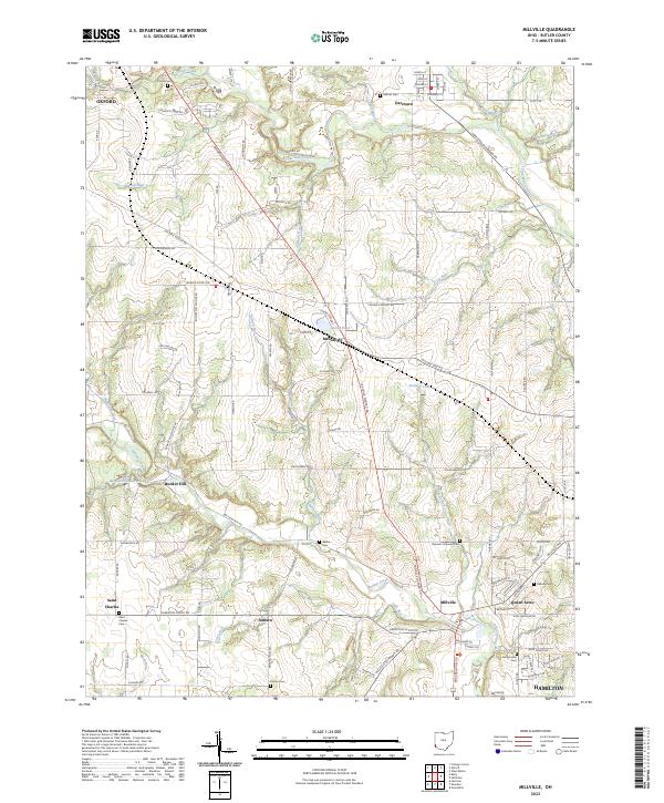
2023 Map of Millville
USGS Topo · Published 2023About this map
Four Mile Creek and Indian Creek carve through the Butler County landscape, shaping the development of rural crossroads and small villages west of Hamilton. This contemporary survey of the region captures the enduring layout of historic settlements like Millville, Darrtown, and McGonigle, where local life has long centered around the intersections of routes like Oxford Millville Rd. Genealogists will find significant value in the distribution of family and community burial grounds, including the Samuel's Lutheran Cem near Millville and the Flankinstein Cem further south. The map illustrates a landscape transitioned from primary agriculture to a mix of rural residential life and preserved open space, seen in features like Bunker Hill Haven Lake and Holiday Lake. From the southern edge of Oxford to the northern reaches of Hamilton, the map documents the persisting footprint of early township boundaries and local roads.
Find a feature on this map
117 named features on this map. Tap any name to fly to it.
Don’t see what you’re looking for? This feature index may not catch every label — zoom into the map to look around manually.
Map Details
Editions of this 2023 Millville Map
This is the sole edition of this map. No revisions or reprints were ever made.
Other maps of this area

1911 · Oxford
USGS Topo · 1:62,500

1915 · College Corner
USGS Topo · 1:48,000

1915 · Harrison
USGS Topo · 1:48,000

1915 · Hamilton
USGS Topo · 1:62,500

1917 · Hamilton
USGS Topo · 1:62,500

1918 · College Corner
USGS Topo · 1:62,500

1953 · Cincinnati
USGS Topo · 1:250,000

1955 · Harrison
USGS Topo · 1:24,000

1955 · Hamilton
USGS Topo · 1:24,000

1955 · Reily
USGS Topo · 1:24,000