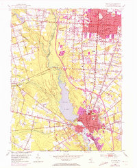
1953 Map of Millville
USGS Topo · Published 1972About this map
Union Lake dominates the central landscape of this South Jersey survey, fed by the waters of the Maurice River. This mid-century map captures a period of significant urban growth between Vineland and Millville, where the established grid of South Vineland and the industrial corridors of the Reading Seashore Line define the region's economy. The settlement patterns reflect a diverse cultural history, evident in sites like the Ukranian Cem, Hebrew Cem, and Sacred Heart Cem.
Find a feature on this map
69 named features on this map. Tap any name to fly to it.
Don’t see what you’re looking for? This feature index may not catch every label — zoom into the map to look around manually.
Map Details
Editions of this 1953 Millville Map
4 editions found
Other maps of this area

1890 · Hammonton
USGS Topo · 1:62,500

1890 · Tuckahoe
USGS Topo · 1:62,500

1890 · Bridgeton
USGS Topo · 1:62,500

1890 · Glassboro
USGS Topo · 1:62,500

1893 · Tuckahoe
USGS Topo · 1:62,500

1894 · Hammonton
USGS Topo · 1:62,500

1894 · Bridgeton
USGS Topo · 1:62,500

1898 · Glassboro
USGS Topo · 1:62,500

1898 · Hammonton
USGS Topo · 1:62,500

1899 · Vineland
USGS Topo · 1:125,000