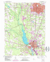
1953 Map of Millville
USGS Topo · Published 1987About this map
The Maurice River valley serves as the central spine of this landscape, dominated by the expansive Union Lake and its surrounding Union Lake Wildlife Management Area. The twin urban centers of Vineland and Millville show significant post-war expansion, indicated by the purple-tinted additions that surround established neighborhood cores like Newcombtown and South Vineland. This mid-century survey captures a diverse institutional landscape, from the sprawling grounds of the State Hospital in the north to the industrial and transport infrastructure of the Conrail lines and the Millville Municipal Airport. For genealogists, the map is particularly detailed regarding burial grounds and community focal points, including the Hebrew Cem, Soldiers Home Cem, and numerous parish sites such as St Peter-Paul Ch Cem. The transition from the structured street grids of Landis Avenue to the outlying marshes like Lummis Marsh Br illustrates the historical boundary between urban development and the Pine Barrens fringe.
Find a feature on this map
63 named features on this map. Tap any name to fly to it.
Don’t see what you’re looking for? This feature index may not catch every label — zoom into the map to look around manually.
Map Details
Editions of this 1953 Millville Map
4 editions found
Other maps of this area

1890 · Hammonton
USGS Topo · 1:62,500

1890 · Tuckahoe
USGS Topo · 1:62,500

1890 · Bridgeton
USGS Topo · 1:62,500

1890 · Glassboro
USGS Topo · 1:62,500

1893 · Tuckahoe
USGS Topo · 1:62,500

1894 · Hammonton
USGS Topo · 1:62,500

1894 · Bridgeton
USGS Topo · 1:62,500

1898 · Glassboro
USGS Topo · 1:62,500

1898 · Hammonton
USGS Topo · 1:62,500

1899 · Vineland
USGS Topo · 1:125,000