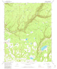
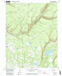
1965 Map of Millwood
USGS Topo · Published 1983About this map
San Juan National Forest provides the setting for this mid-1960s study of water management and former industrial activity in southwestern Colorado. An Old Railroad Grade winds through the terrain, suggesting a history of timber extraction or transport that predates the 1965 field check. The landscape is heavily marked by small-scale irrigation and storage infrastructure, with numerous reservoirs and ditches supporting local water needs. Notable water features include Joe Moore Reservoir, Jackson Gulch Reservoir, and Bauer Lake.
Find a feature on this map
50 named features on this map. Tap any name to fly to it.
Don’t see what you’re looking for? This feature index may not catch every label — zoom into the map to look around manually.
Map Details
Editions of this 1965 Millwood Map
5 editions found
Other maps of this area

1895 · La Plata
USGS Topo · 1:62,500

1897 · La Plata
USGS Topo · 1:62,500

1897 · Rico
USGS Topo · 1:62,500

1898 · Rico
USGS Topo · 1:62,500

1899 · La Plata
USGS Topo · 1:62,500

1899 · Rico
USGS Topo · 1:62,500

1908 · La Plata
USGS Topo · 1:62,500

1956 · Cortez
USGS Topo · 1:250,000

1958 · Cortez
USGS Topo · 1:250,000

1959 · Cortez
USGS Topo · 1:250,000