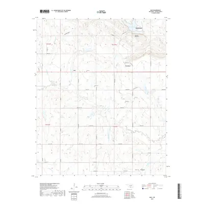
2018 Map of Milo
USGS Topo · Published 2018About this map
Arbuckle Mountains terrain defines this portion of Carter County, where the southern foothills meet a complex network of creeks and branches. Small rural settlements like Milo and Woodford serve as anchors for the surrounding agricultural and ranching landscape. The area is notably dense with small family or community burial grounds, including the Milo Cem, Woodford Cem, and the remote Pruitt Cem, providing significant touchpoints for genealogical research in this part of Oklahoma.
Find a feature on this map
56 named features on this map. Tap any name to fly to it.
Don’t see what you’re looking for? This feature index may not catch every label — zoom into the map to look around manually.
Map Details
Editions of this 2018 Milo Map
This is the sole edition of this map. No revisions or reprints were ever made.
Other maps of this area

1901 · Ardmore
USGS Topo · 1:125,000

1918 · Ardmore
USGS Topo · 1:125,000

1957 · Ardmore
USGS Topo · 1:250,000

1963 · Ardmore
USGS Topo · 1:250,000

1964 · Ardmore West
USGS Topo · 1:24,000

1964 · Springer
USGS Topo · 1:24,000

1964 · Turner Falls
USGS Topo · 1:24,000

1968 · Fox NE
USGS Topo · 1:24,000

1969 · Healdton
USGS Topo · 1:24,000

1969 · Lone Grove
USGS Topo · 1:24,000