
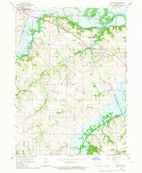
1965 Map of Milo
USGS Topo · Published 1966About this map
Milo serves as the central hub for this mid-1960s study of Warren County, positioned where a grid of rural roads converges amidst the rolling agricultural landscape of Belmont and Lincoln townships. To the north, the small settlements of Ackworth and Sandyville anchor their respective corners of the quadrangle, connected by the drainage systems of the South River and Coal Creek. A prominent Old Railroad Grade traces a diagonal path south of Ackworth, signaling a shift in the local transport network as rail gave way to modern thoroughfares.
Find a feature on this map
19 named features on this map. Tap any name to fly to it.
Don’t see what you’re looking for? This feature index may not catch every label — zoom into the map to look around manually.
Map Details
Editions of this 1965 Milo Map
This is the sole edition of this map. No revisions or reprints were ever made.
Other maps of this area

1910 · Milo
USGS Topo · 1:62,500

1918 · Chariton
USGS Topo · 1:62,500

1931 · Indianola
USGS Topo · 1:62,500

1950 · New Virginia
USGS Topo · 1:62,500

1952 · New Virginia
USGS Topo · 1:62,500

1954 · Des Moines
USGS Topo · 1:250,000

1956 · Des Moines
USGS Topo · 1:250,000

1957 · Des Moines
USGS Topo · 1:250,000

1965 · Pleasantville
USGS Topo · 1:24,000
1965 · Hartford
USGS Topo · 1:24,000