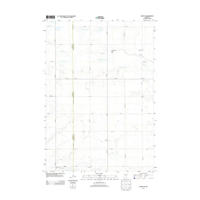
2013 Map of Milroy SE
USGS Topo · Published 2013About this map
Tracy sits in the southwestern corner of this landscape, where the agricultural grid of Lyon and Redwood counties meets the Cottonwood River valley. The map documents a predominantly rural environment defined by a rigid network of section-line roads like Lyon Redwood Rd and Co Hwy-4. A high concentration of burial sites, including Old Gales Cem, Gales Cem, Luther Cem, Swedish Cem, and Calvary Cem, suggests a long-settled community with distinct cultural or denominational enclaves. The hydrology is marked by the presence of the Nettlewynnt Lake Bed and the winding courses of Lone Tree Cr and Meadow Cr, which break the geometric precision of the surrounding farmland. This modern survey provides an exact record of the contemporary prairie landscape, from the Tracy Municipal Airport to the scattered farmsteads that anchor this region of Minnesota.
Find a feature on this map
30 named features on this map. Tap any name to fly to it.
Don’t see what you’re looking for? This feature index may not catch every label — zoom into the map to look around manually.
Map Details
Editions of this 2013 Milroy SE Map
This is the sole edition of this map. No revisions or reprints were ever made.
Other maps of this area

1953 · New Ulm
USGS Topo · 1:250,000

1957 · New Ulm
USGS Topo · 1:250,000

1958 · New Ulm
USGS Topo · 1:250,000

1962 · Dudley
USGS Topo · 1:24,000

1962 · Milroy SE
USGS Topo · 1:24,000

1962 · Amiret
USGS Topo · 1:24,000

1962 · Milroy
USGS Topo · 1:24,000

1967 · New Ulm
USGS Topo · 1:250,000

1967 · Walnut Grove
USGS Topo · 1:24,000

1967 · Tracy East
USGS Topo · 1:24,000