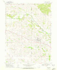
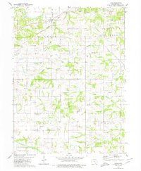
1970 Map of Milton
USGS Topo · Published 1972About this map
Milton serves as the central hub of this Iowa landscape, straddling the border between Davis and Van Buren counties. The town's layout reflects its historical reliance on transportation, centered along the Old Railroad Grade that cuts diagonally across the prairie. This former rail corridor illustrates the shift in rural commerce as mid-century infrastructure evolved, leaving behind a clear path through Prairie and Jackson townships.
Find a feature on this map
17 named features on this map. Tap any name to fly to it.
Don’t see what you’re looking for? This feature index may not catch every label — zoom into the map to look around manually.
Map Details
Editions of this 1970 Milton Map
This is the sole edition of this map. No revisions or reprints were ever made.
Other maps of this area

1954 · Centerville
USGS Topo · 1:250,000

1956 · Ottumwa South
USGS Topo · 1:62,500

1957 · Centerville
USGS Topo · 1:250,000

1958 · Centerville
USGS Topo · 1:250,000

1965 · Selma
USGS Topo · 1:24,000

1965 · Douds
USGS Topo · 1:24,000
1970 · Cantril
USGS Topo · 1:24,000
1970 · Brock
USGS Topo · 1:24,000
1970 · Azen
USGS Topo · 1:24,000
1979 · Floris
USGS Topo · 1:24,000