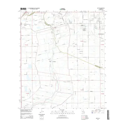
2015 Map of Milton
USGS Topo · Published 2015About this map
The Vermilion River carves a winding path through this portion of Acadiana, serving as a primary boundary between Lafayette and Vermilion Parishes. This 2015 survey illustrates a landscape defined by its intricate drainage network, where natural coulees such as Anselm Coulee and Coulee Kenny meet engineered features like the Steiner Canal and LeBlanc Ditch. These waterways historically dictated the settlement patterns of towns like Milton and Maurice, and the development of agricultural lands in the surrounding townships.
Find a feature on this map
165 named features on this map. Tap any name to fly to it.
Don’t see what you’re looking for? This feature index may not catch every label — zoom into the map to look around manually.
Map Details
Editions of this 2015 Milton Map
This is the sole edition of this map. No revisions or reprints were ever made.
Other maps of this area

1932 · Abbeville NE
USGS Topo · 1:31,680

1932 · Abbeville NW
USGS Topo · 1:31,680

1934 · Duson
USGS Topo · 1:31,680

1937 · Derouen
USGS Topo · 1:62,500

1939 · St. Martinsville
USGS Topo · 1:62,500

1945 · New Orleans
USGS Topo · 1:250,000

1946 · Milton
USGS Topo · 1:31,680

1946 · Leroy
USGS Topo · 1:31,680

1946 · Lafayette
USGS Topo · 1:31,680

1952 · Lake Charles
USGS Topo · 1:250,000