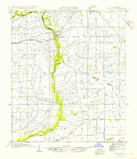
1954 Map of Milton
USGS Topo · Published 1954About this map
The Vermilion River carves a winding path through the heart of the Acadiana landscape, serving as a natural boundary between Lafayette Parish and Vermilion Parish. This mid-century survey illustrates an agrarian economy defined by both natural watercourses and engineered waterways like the Hunter Irrigation Canal. The settlement at Milton sits prominently along the river, while the Southern Pacific railroad line links nearby Flanders and Youngsville, facilitating the movement of local goods. Educational life is anchored by rural institutions such as Le Blanc Sch and Langlinais Sch, which reflect the community's dispersed settlement pattern. In addition to the larger towns, smaller locales like Maurice appear alongside established transport routes including State Highway No. 175, showing the transition of the region's infrastructure prior to late-century developments.
Find a feature on this map
15 named features on this map. Tap any name to fly to it.
Don’t see what you’re looking for? This feature index may not catch every label — zoom into the map to look around manually.
Map Details
Editions of this 1954 Milton Map
This is the sole edition of this map. No revisions or reprints were ever made.
Other maps of this area

1932 · Abbeville NE
USGS Topo · 1:31,680

1932 · Abbeville NW
USGS Topo · 1:31,680

1934 · Duson
USGS Topo · 1:31,680

1937 · Derouen
USGS Topo · 1:62,500

1939 · St. Martinsville
USGS Topo · 1:62,500

1945 · New Orleans
USGS Topo · 1:250,000

1946 · Milton
USGS Topo · 1:31,680

1946 · Leroy
USGS Topo · 1:31,680

1946 · Lafayette
USGS Topo · 1:31,680

1952 · Lake Charles
USGS Topo · 1:250,000