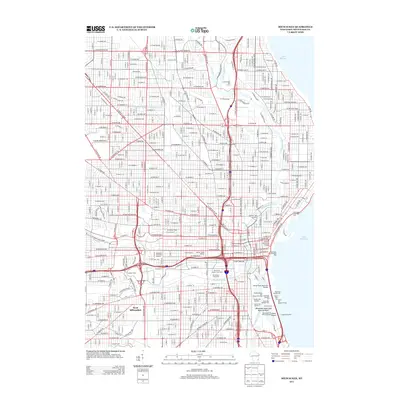
2013 Map of Milwaukee
USGS Topo · Published 2013About this map
The Milwaukee River and Menomonee River converge in this urban survey, revealing the intricate industrial and maritime infrastructure of Wisconsin's largest port. The waterfront is defined by a complex network of docks and shipping slips along Jones Island, including the Milwaukee City Bulk Cargo Dock and the Milwaukee Municipal Mooring Basin. This industrial heart is connected by the towering Daniel Hoan Memorial Bridge, while the Milwaukee Passenger Pier marks the city's interface with Lake Michigan.
Find a feature on this map
122 named features on this map. Tap any name to fly to it.
Don’t see what you’re looking for? This feature index may not catch every label — zoom into the map to look around manually.
Map Details
Editions of this 2013 Milwaukee Map
This is the sole edition of this map. No revisions or reprints were ever made.
Other maps of this area

1891 · Bayview
USGS Topo · 1:62,500

1891 · Muskego
USGS Topo · 1:62,500

1892 · Milwaukee
USGS Topo · 1:62,500

1892 · Waukesha
USGS Topo · 1:62,500

1901 · Milwaukee
USGS Topo · 1:62,500

1901 · Waukesha
USGS Topo · 1:62,500

1901 · Bayview
USGS Topo · 1:62,500

1901 · Muskego
USGS Topo · 1:62,500

1906 · Waukesha
USGS Topo · 1:62,500

1906 · Milwaukee
USGS Topo · 1:62,500