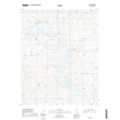
2017 Map of Mincy
USGS Topo · Published 2017About this map
Bull Shoals Lake dominates this Taney County landscape, its winding fingers reaching into the valleys of southern Missouri. The settlement of Mincy serves as a focal point near the western edge of the quadrangle, surrounded by a network of drainage systems including Little Mincy Cr and Mincy Cr. The terrain is defined by dramatic relief, featuring numerous named hollows such as Fox Creek Hollow and White Oak Hollow, and prominent overlooks like Mays Bluff above Mays Bend. Local heritage is well-preserved through several small burial grounds, including Mincy Cem, Cobles Cem, and Bee Creek Cem. Aviation infrastructure is notably present even in this rural setting, with Misty Meadows Airport and the Brass Lantern Airpark providing access to the rugged Ozark terrain. Transportation is largely defined by state routes like State Hwy J and State Hwy K, which follow the ridges between the deep incisions of Yocum Cr and Bear Cr.
Find a feature on this map
72 named features on this map. Tap any name to fly to it.
Don’t see what you’re looking for? This feature index may not catch every label — zoom into the map to look around manually.
Map Details
Editions of this 2017 Mincy Map
This is the sole edition of this map. No revisions or reprints were ever made.
Other maps of this area

1893 · Yellville
USGS Topo · 1:125,000

1903 · Yellville
USGS Topo · 1:125,000

1904 · Harrison
USGS Topo · 1:125,000

1905 · Harrison
USGS Topo · 1:125,000

1905 · Yellville
USGS Topo · 1:125,000

1907 · Forsyth
USGS Topo · 1:125,000

1929 · Yellville
USGS Topo · 1:125,000

1943 · Protem
USGS Topo · 1:62,500

1945 · Harrison
USGS Topo · 1:250,000

1949 · Harrison
USGS Topo · 1:250,000