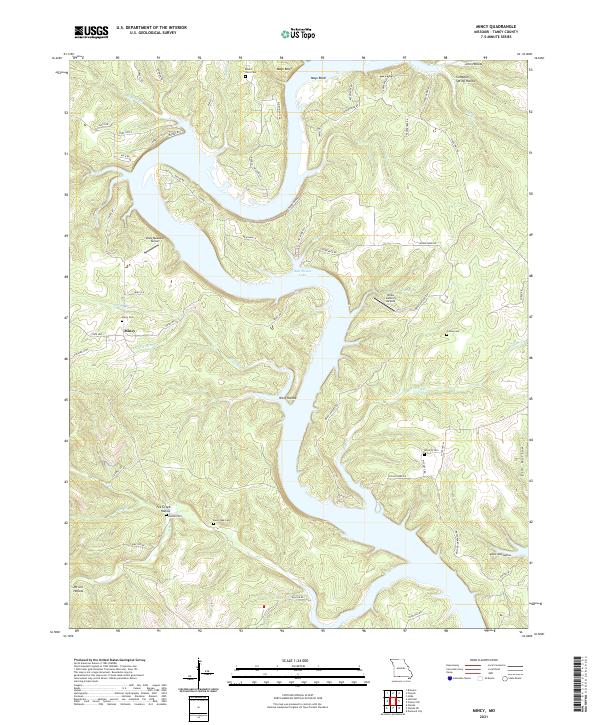
2021 Map of Mincy
USGS Topo · Published 2021About this map
Mincy sits at the heart of this Taney County landscape, where the southern reaches of Bull Shoals Lake wind through the deeply incised Ozark terrain. The settlement pattern is defined by the winding paths of State Hwy J and State Hwy K, connecting small communities and family landmarks. This modern survey reflects the enduring character of the region, where numerous family cemeteries like Boothe Cem and Cobles Cem remain preserved alongside newer developments like Misty Meadows Airport.
Find a feature on this map
70 named features on this map. Tap any name to fly to it.
Don’t see what you’re looking for? This feature index may not catch every label — zoom into the map to look around manually.
Map Details
Editions of this 2021 Mincy Map
This is the sole edition of this map. No revisions or reprints were ever made.
Other maps of this area

1893 · Yellville
USGS Topo · 1:125,000

1903 · Yellville
USGS Topo · 1:125,000

1904 · Harrison
USGS Topo · 1:125,000

1905 · Harrison
USGS Topo · 1:125,000

1905 · Yellville
USGS Topo · 1:125,000

1907 · Forsyth
USGS Topo · 1:125,000

1929 · Yellville
USGS Topo · 1:125,000

1943 · Protem
USGS Topo · 1:62,500

1945 · Harrison
USGS Topo · 1:250,000

1949 · Harrison
USGS Topo · 1:250,000