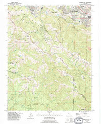
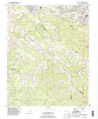
1991 Map of Mindego Hill
USGS Topo · Published 1995About this map
Portola Valley and the northern reaches of the Santa Cruz Mountains define this landscape in the early 1990s, where residential communities like Los Altos Hills and Los Trancos Woods meet a complex network of protected lands. The map illustrates the transition from academic and suburban hubs, such as Foothill College and Corte Madera Middle Sch, into the dense watersheds of the Pescadero Creek County Park and Portola State Park. Notable landmarks including Black Mountain and Mindego Hill rise above a labyrinth of ridges and gulches, such as Coal Mine Ridge and Hamms Gulch. The presence of the San Francisco Log Cabin Ranch and the Heritage Grove Redwood Preserve reflects a long-standing regional commitment to diverse land use, from correctional agriculture to forest conservation.
Find a feature on this map
85 named features on this map. Tap any name to fly to it.
Don’t see what you’re looking for? This feature index may not catch every label — zoom into the map to look around manually.
Map Details
Editions of this 1991 Mindego Hill Map
2 editions found
Other maps of this area

1897 · Palo Alto
USGS Topo · 1:62,500

1899 · Palo Alto
USGS Topo · 1:62,500

1902 · Santa Cruz
USGS Topo · 1:125,000
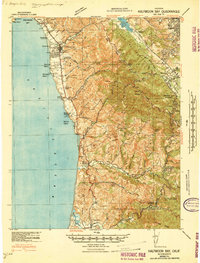
1940 · Halfmoon Bay
USGS Topo · 1:62,500

1940 · Ano Nuevo
USGS Topo · 1:62,500

1941 · Ano Nuevo Pt.
USGS Topo · 1:62,500

1941 · Palo Alto
USGS Topo · 1:62,500
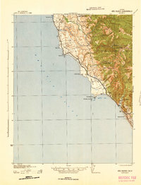
1942 · Ano Nuevo
USGS Topo · 1:62,500

1943 · Palo Alto
USGS Topo · 1:62,500

1943 · Halfmoon Bay
USGS Topo · 1:62,500