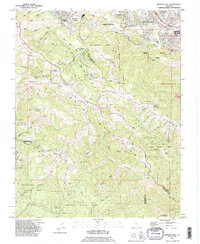
1991 Map of Mindego Hill
USGS Topo · Published 1995About this map
Portola Valley and the surrounding crests of the Santa Cruz Mountains define this landscape during the early 1990s. The map illustrates a complex intersection of suburban expansion and massive conservation efforts, where developed areas like Los Altos Hills and Los Trancos Woods give way to an extensive network of protected lands, including Portola State Park and the Heritage Grove Redwood Preserve. The geological significance of the area is prominently marked by the San Andreas Rift Zone, which cuts northwest across the terrain, influencing the drainage patterns of Los Trancos Creek and Stevens Creek. Institutional landmarks such as Foothill College and the San Francisco Log Cabin Ranch appear alongside legacy land grants like La Purisima Concepcion, bridging the gap between Spanish-era ranchos and modern residential developments.
Find a feature on this map
68 named features on this map. Tap any name to fly to it.
Don’t see what you’re looking for? This feature index may not catch every label — zoom into the map to look around manually.
Map Details
Editions of this 1991 Mindego Hill Map
2 editions found
Other maps of this area

1897 · Palo Alto
USGS Topo · 1:62,500

1899 · Palo Alto
USGS Topo · 1:62,500

1902 · Santa Cruz
USGS Topo · 1:125,000

1940 · Halfmoon Bay
USGS Topo · 1:62,500

1940 · Ano Nuevo
USGS Topo · 1:62,500

1941 · Ano Nuevo Pt.
USGS Topo · 1:62,500

1941 · Palo Alto
USGS Topo · 1:62,500

1942 · Ano Nuevo
USGS Topo · 1:62,500

1943 · Palo Alto
USGS Topo · 1:62,500

1943 · Halfmoon Bay
USGS Topo · 1:62,500