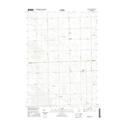
2017 Map of Minden City
USGS Topo · Published 2017About this map
Minden City serves as a primary hub within this agricultural landscape along the border of Sanilac and Huron counties. The settlement pattern is defined by a rigid grid of rural roads like Priemer Rd and Huron Line Rd, connecting small communities such as Parisville and the southern hamlet of Peatville. The geography here is notably defined by its complex drainage network, where the headwaters of several systems emerge, including the S Fork Cass River and the Black River. Numerous managed waterways like Lloyd Drain and Darlington Drain intersect the fields, reflecting a century of land reclamation for farming. For those tracing local heritage, the map identifies significant sites such as Saint Mary's Catholic Cem and Saint Patricks Cem, which stand as enduring landmarks of the area's early parishes and family histories.
Find a feature on this map
48 named features on this map. Tap any name to fly to it.
Don’t see what you’re looking for? This feature index may not catch every label — zoom into the map to look around manually.
Map Details
Editions of this 2017 Minden City Map
This is the sole edition of this map. No revisions or reprints were ever made.
Other maps of this area

1954 · Flint
USGS Topo · 1:250,000

1958 · Flint
USGS Topo · 1:250,000

1963 · Ruth
USGS Topo · 1:24,000

1963 · Ubly
USGS Topo · 1:24,000

1963 · Minden City
USGS Topo · 1:24,000

1963 · Palms
USGS Topo · 1:24,000

1963 · Deckerville
USGS Topo · 1:24,000

1963 · Argyle
USGS Topo · 1:24,000

1970 · Harbor Beach
USGS Topo · 1:24,000

1970 · Bad Axe SE
USGS Topo · 1:24,000