
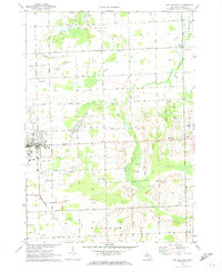
1963 Map of Minden City
USGS Topo · Published 1964About this map
The Huron Co Sanilac Co line divides a landscape deeply shaped by drainage and extraction in the early 1960s. The southern portion of the quadrangle is dominated by the Minden City State Game Area, which contains a massive Peat Bog and the headwaters of the Black River. This wet, low-lying terrain stands in contrast to the surrounding agricultural grid, which is networked by an extensive system of man-made waterways including Cook Drain, Baltzer Drain, and Grifka Drain.
Find a feature on this map
42 named features on this map. Tap any name to fly to it.
Don’t see what you’re looking for? This feature index may not catch every label — zoom into the map to look around manually.
Map Details
Editions of this 1963 Minden City Map
This is the sole edition of this map. No revisions or reprints were ever made.
Other maps of this area

1954 · Flint
USGS Topo · 1:250,000

1958 · Flint
USGS Topo · 1:250,000

1963 · Ruth
USGS Topo · 1:24,000

1963 · Ubly
USGS Topo · 1:24,000

1963 · Palms
USGS Topo · 1:24,000

1963 · Deckerville
USGS Topo · 1:24,000

1963 · Argyle
USGS Topo · 1:24,000

1970 · Harbor Beach
USGS Topo · 1:24,000

1970 · Bad Axe SE
USGS Topo · 1:24,000
1970 · Bad Axe East
USGS Topo · 1:24,000
Featured Places
- Minden City, Minden Township
- Sherman Township, MI
- Paris Township, MI
- New Parisville, Paris Township
- Pawlowski, Paris Township