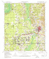
1947 Map of Minden
USGS Topo · Published 1980About this map
Minden and its surrounding parish lands are defined by a mix of heavy industry and small rural congregations just after World War II. The sprawling Louisiana Ordnance Plant occupies a significant portion of the central landscape, a reminder of the region's mobilization during the war years. To the west, the Bellevue Oilfield indicates the importance of petroleum extraction to the local economy. The terrain is crisscrossed by railroads including the Kansas City Southern and the Illinois Central, which serviced both the industrial hubs and the agricultural communities like Doyline and Sibley.
Find a feature on this map
74 named features on this map. Tap any name to fly to it.
Don’t see what you’re looking for? This feature index may not catch every label — zoom into the map to look around manually.
Map Details
Editions of this 1947 Minden Map
2 editions found
Other maps of this area

1922 · Sarepta
USGS Topo · 1:62,500

1924 · Sarepta
USGS Topo · 1:62,500

1932 · Bossier SE
USGS Topo · 1:31,680

1932 · Bossier NE
USGS Topo · 1:31,680

1938 · Arnsberg
USGS Topo · 1:31,680

1947 · Ringgold
USGS Topo · 1:62,500

1947 · Minden
USGS Topo · 1:62,500

1948 · Bossier City
USGS Topo · 1:62,500

1948 · Caspiana
USGS Topo · 1:62,500

1948 · Jamestown
USGS Topo · 1:62,500