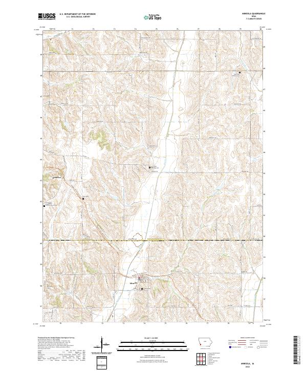
2022 Map of Mineola
USGS Topo · Published 2022About this map
The unincorporated community of Mineola sits at the southern end of this western Iowa landscape, where the Wabash Trace Nature Trl follows the historical rail alignment through the valley. The terrain is defined by the winding course of Keg Creek and its tributaries, including Snake Cr, which carve through the loess hills straddling the border of Pottawattamie and Mills counties. This area maintains its agricultural character, with scattered farmsteads connected by a grid of secondary roads like Pioneer Trl and Applewood Rd.
Find a feature on this map
42 named features on this map. Tap any name to fly to it.
Don’t see what you’re looking for? This feature index may not catch every label — zoom into the map to look around manually.
Map Details
Editions of this 2022 Mineola Map
This is the sole edition of this map. No revisions or reprints were ever made.
Other maps of this area

1893 · Omaha
USGS Topo · 1:62,500

1954 · Omaha
USGS Topo · 1:250,000

1956 · Glenwood
USGS Topo · 1:24,000

1956 · Mineola
USGS Topo · 1:24,000

1956 · Council Bluffs North
USGS Topo · 1:24,000

1956 · Pacific Junction
USGS Topo · 1:24,000

1956 · Treynor
USGS Topo · 1:24,000

1956 · Mc Clelland
USGS Topo · 1:24,000

1956 · Council Bluffs South
USGS Topo · 1:24,000

1956 · Malvern
USGS Topo · 1:24,000