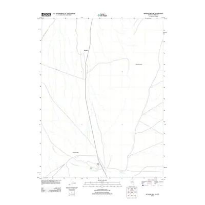
2012 Map of Mineral Hill SW
USGS Topo · Published 2012About this map
Alpha and the nearby Alpha Ranch anchor the southern reaches of this Eureka County landscape, where the wide expanse of Garden Valley meets the rising terrain of Table Mountain. The settlement pattern is defined by the historic routes that cut through the high desert, including the road from J D Ranch to Mineral Sta and the Alpha-Tonkin route. These pathways trace the movements of early ranching and mining traffic between regional stations and outposts like Shannon. Hydrology is sparse but vital here, with drainage provided by Henderson Creek and a localized water source at Chimney Springs. The map provides a clear look at the rural infrastructure and land use in central Nevada during the early 21st century, showing how modern ranching outposts continue to utilize the same geography established by nineteenth-century pioneers.
Find a feature on this map
10 named features on this map. Tap any name to fly to it.
Don’t see what you’re looking for? This feature index may not catch every label — zoom into the map to look around manually.
Map Details
Editions of this 2012 Mineral Hill SW Map
This is the sole edition of this map. No revisions or reprints were ever made.
Other maps of this area

1926 · Roberts Mountains
USGS Topo · 1:250,000

1929 · Roberts Mountains
USGS Topo · 1:250,000

1937 · Mineral Hill
USGS Topo · 1:48,000

1943 · Mineral Hill
USGS Topo · 1:62,500

1949 · Garden Valley
USGS Topo · 1:62,500

1949 · Roberts Creek Mtn
USGS Topo · 1:62,500

1951 · Roberts Creek Mtn
USGS Topo · 1:62,500

1951 · Garden Valley
USGS Topo · 1:62,500

1955 · Millett
USGS Topo · 1:250,000

1955 · Winnemucca
USGS Topo · 1:250,000