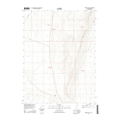
2014 Map of Mineral Hill SW
USGS Topo · Published 2014About this map
Alpha and Shannon anchor this high-desert landscape in Eureka County, positioned along a transport corridor that defines the local geography. The area is characterized by a stark transition from the flat basins where Henderson Cr flows to the elevated terrain of Table Mtn and the narrow incision of Rocky Gulch. In the southeastern corner, Chimney Springs provides a critical water source in a region primarily defined by its drainage patterns and township divisions. The network of historical ranching and mining access routes, including Alpha-Tonkin Rd and JD Ranch Mineral Station Rd, illustrates the infrastructure required to navigate this portion of central Nevada. This 2014 survey documents the enduring physical landmarks and sparse settlement patterns that have persisted through decades of land use in the Mineral Hill region.
Find a feature on this map
13 named features on this map. Tap any name to fly to it.
Don’t see what you’re looking for? This feature index may not catch every label — zoom into the map to look around manually.
Map Details
Editions of this 2014 Mineral Hill SW Map
This is the sole edition of this map. No revisions or reprints were ever made.
Other maps of this area

1926 · Roberts Mountains
USGS Topo · 1:250,000

1929 · Roberts Mountains
USGS Topo · 1:250,000

1937 · Mineral Hill
USGS Topo · 1:48,000

1943 · Mineral Hill
USGS Topo · 1:62,500

1949 · Garden Valley
USGS Topo · 1:62,500

1949 · Roberts Creek Mtn
USGS Topo · 1:62,500

1951 · Roberts Creek Mtn
USGS Topo · 1:62,500

1951 · Garden Valley
USGS Topo · 1:62,500

1955 · Millett
USGS Topo · 1:250,000

1955 · Winnemucca
USGS Topo · 1:250,000