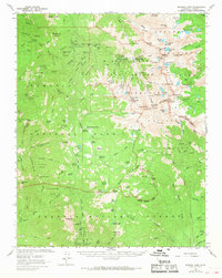
1967 Map of Mineral King
USGS Topo · Published 1968About this map
Mineral King (Mineralking PO) and the high Sierra backcountry of the Sequoia National Park define this 1967 survey. The landscape is characterized by a dense network of Sierra Redwoods, including the Oriole Grove, and high alpine basins dotted with glacial lakes like Eagle Lake and Monarch Lakes. Human activity is concentrated along the East Fork Kaweah River, where Silver City and Camp Conifer provide small hubs of settlement amid the high-altitude terrain. The map records essential wilderness infrastructure for the era, such as the Atwell Mill Ranger Station, the Mineral King Guard Station, and the Cahoon Rock Lookout. The presence of the Hockett Trail and Mineral King Trail highlights the historic routes used to navigate the Western Divide and the surrounding mountain passes.
Find a feature on this map
139 named features on this map. Tap any name to fly to it.
Don’t see what you’re looking for? This feature index may not catch every label — zoom into the map to look around manually.
Map Details
Editions of this 1967 Mineral King Map
2 editions found
Other maps of this area

1903 · Tehipite
USGS Topo · 1:125,000

1904 · Kaweah
USGS Topo · 1:125,000

1905 · Tehipite
USGS Topo · 1:125,000

1905 · Olancha
USGS Topo · 1:125,000

1907 · Olancha
USGS Topo · 1:125,000

1907 · Mt. Whitney
USGS Topo · 1:125,000

1909 · Kaweah
USGS Topo · 1:125,000

1919 · Mt. Whitney
USGS Topo · 1:125,000

1937 · Mt. Whitney
USGS Topo · 1:125,000

1937 · Kaweah
USGS Topo · 1:125,000