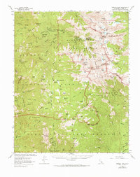
1967 Map of Mineral King
USGS Topo · Published 1973About this map
Silver City stands as the primary outpost in this high-altitude landscape of the Sierra Nevada, where protected forests and groves of giant sequoias dominate the terrain. The presence of the Atwell Mill Ranger Station and Atwell Mill Campground highlights the historical timber and recreation legacy of the East Fork Kaweah River drainage. Higher elevations are marked by the Mineral King Guard Station and the Mineral King Game Refuge, preserving a wilderness character defined by dozens of named meadows and alpine lakes.
Find a feature on this map
128 named features on this map. Tap any name to fly to it.
Don’t see what you’re looking for? This feature index may not catch every label — zoom into the map to look around manually.
Map Details
Editions of this 1967 Mineral King Map
2 editions found
Other maps of this area

1903 · Tehipite
USGS Topo · 1:125,000

1904 · Kaweah
USGS Topo · 1:125,000

1905 · Tehipite
USGS Topo · 1:125,000

1905 · Olancha
USGS Topo · 1:125,000

1907 · Olancha
USGS Topo · 1:125,000

1907 · Mt. Whitney
USGS Topo · 1:125,000

1909 · Kaweah
USGS Topo · 1:125,000

1919 · Mt. Whitney
USGS Topo · 1:125,000

1937 · Mt. Whitney
USGS Topo · 1:125,000

1937 · Kaweah
USGS Topo · 1:125,000