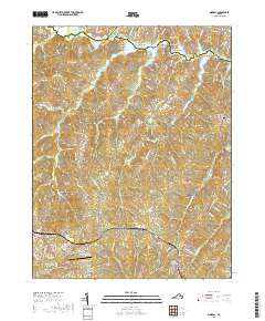
2019 Map of Mineral
USGS Topo · Published 2019About this map
Louisa and Mineral anchor the southwestern and southeastern corners of this 2019 survey, illustrating the modern rural and suburban character of Louisa County. The landscape is defined by the expansive waters of Lake Anna to the north, where numerous named landforms like Sunning Island, Martins Point, and Bazzanella Point mark the intricate shoreline. The CSX Transportation line runs through the southern portion of the quadrangle, serving the town of Mineral and passing near the Louisa County High School.
Find a feature on this map
123 named features on this map. Tap any name to fly to it.
Don’t see what you’re looking for? This feature index may not catch every label — zoom into the map to look around manually.
Map Details
Editions of this 2019 Mineral Map
This is the sole edition of this map. No revisions or reprints were ever made.
Other maps of this area

1887 · Spottsylvania
USGS Topo · 1:125,000

1890 · Goochland
USGS Topo · 1:125,000

1891 · Palmyra
USGS Topo · 1:125,000

1892 · Spottsylvania
USGS Topo · 1:125,000

1892 · Goochland
USGS Topo · 1:125,000

1892 · Gordonsville
USGS Topo · 1:125,000

1895 · Palmyra
USGS Topo · 1:125,000

1897 · Palmyra
USGS Topo · 1:125,000

1942 · Mineral
USGS Topo · 1:31,680

1942 · Lahore
USGS Topo · 1:31,680