1942 Map of Mineral
USGS Topo · Published 1961About this map
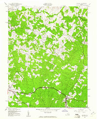
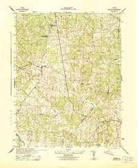
The Chesapeake and Ohio railroad corridor anchors the southern portion of this landscape, connecting the town of Mineral with the nearby settlement of Louisa. This 1942 survey reveals a rural Piedmont environment transitioning between small farm clusters and forest, where the North Anna River defines the border between Louisa, Orange, and Spotsylvania counties. The map reflects a deeply rooted community infrastructure, documented through numerous country churches such as Gold Mine Ch, Enon Ch, and Mt Pleasant Ch.
Find a feature on this map
23 named features on this map. Tap any name to fly to it.
Don’t see what you’re looking for? This feature index may not catch every label — zoom into the map to look around manually.
Map Details
Editions of this 1942 Mineral Map
2 editions found
Other maps of this area

1887 · Spottsylvania
USGS Topo · 1:125,000

1890 · Goochland
USGS Topo · 1:125,000

1891 · Palmyra
USGS Topo · 1:125,000

1892 · Spottsylvania
USGS Topo · 1:125,000

1892 · Goochland
USGS Topo · 1:125,000

1892 · Gordonsville
USGS Topo · 1:125,000

1895 · Palmyra
USGS Topo · 1:125,000

1897 · Palmyra
USGS Topo · 1:125,000
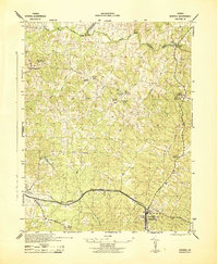
1942 · Mineral
USGS Topo · 1:31,680
1942 · Lahore
USGS Topo · 1:31,680