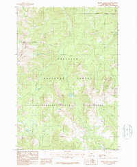
1987 Map of Mineral Mountain
USGS Topo · Published 1987About this map
Mineral Mountain serves as a prominent landmark within this 1987 survey of a high-elevation backcountry in the Gallatin National Forest. The landscape is dominated by the protected expanses of the Absaroka-Beartooth Wilderness, where steep drainage systems feed a network of alpine water bodies. Significant water features include Arrastra Lake in the northwest and Charlie White Lake in the southeast, connected by the rugged hydrology of Mill Creek and Thompson Creek. The map documents the primitive character of this area before modern expansion, highlighting the complex network of forks and creeks like East Fork Bear Creek and West Fork Horse Creek. Isolated features like Lonesome Pond and Knox Lake further characterize the remote wilderness environment of Park County.
Find a feature on this map
20 named features on this map. Tap any name to fly to it.
Don’t see what you’re looking for? This feature index may not catch every label — zoom into the map to look around manually.
Map Details
Editions of this 1987 Mineral Mountain Map
2 editions found
Other maps of this area

1891 · Livingston
USGS Topo · 1:250,000

1893 · Livingston
USGS Topo · 1:250,000

1940 · Mt. Cowen
USGS Topo · 1:62,500

1940 · Mt Wallace
USGS Topo · 1:62,500

1943 · Mt Wallace
USGS Topo · 1:62,500

1943 · Mt Cowen
USGS Topo · 1:62,500

1947 · Bozeman
USGS Topo · 1:250,000

1948 · Bozeman
USGS Topo · 1:250,000

1955 · Bozeman
USGS Topo · 1:250,000

1955 · Emigrant
USGS Topo · 1:62,500