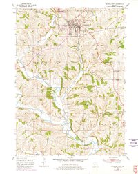
1952 Map of Mineral Point
USGS Topo · Published 1980About this map
Mineral Point stands as the primary hub of this Iowa County landscape, its street grid densely packed near the County Fairground and Soldiers Memorial Park. The city is served by the Chicago Milwaukee St Paul and Pacific railroad, which follows the winding course of Brewery Creek through the rugged driftless terrain. This 1952 survey, with revisions from 1978, illustrates a rural economy transitioning from intensive mining to agriculture. Numerous Quarries dot the hillsides, particularly near the Pecatonica River and Slateford.
Find a feature on this map
31 named features on this map. Tap any name to fly to it.
Don’t see what you’re looking for? This feature index may not catch every label — zoom into the map to look around manually.
Map Details
Editions of this 1952 Mineral Point Map
3 editions found
Other maps of this area

1902 · Mineral Point
USGS Topo · 1:125,000

1952 · Calamine
USGS Topo · 1:24,000

1952 · Mineral Point
USGS Topo · 1:24,000

1952 · Dodgeville
USGS Topo · 1:24,000

1952 · Belmont
USGS Topo · 1:24,000

1952 · Linden
USGS Topo · 1:24,000

1952 · Mifflin
USGS Topo · 1:24,000

1959 · Dubuque
USGS Topo · 1:250,000

1961 · Dubuque
USGS Topo · 1:250,000

1962 · Dubuque
USGS Topo · 1:250,000