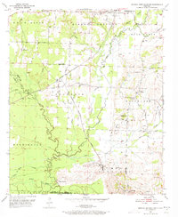
1951 Map of Mineral Springs South
USGS Topo · Published 1973About this map
Saline Landing marks a point of historical transition along the winding Saline River, where the landscape of Howard County meets Sevier and Little River counties. In the early 1950s, this region was defined by small rural hubs and a network of country churches, including Shiloh Ch, Tabernacle Ch, and Bright Star Ch. The industrial footprint of the era is evidenced by a Quarry near the settlement of Okay, while the local rail economy is anchored by the Graysonia Nashville and Ashdown railroad line.
Find a feature on this map
42 named features on this map. Tap any name to fly to it.
Don’t see what you’re looking for? This feature index may not catch every label — zoom into the map to look around manually.
Map Details
Editions of this 1951 Mineral Springs South Map
4 editions found
Other maps of this area

1950 · Ashdown East
USGS Topo · 1:24,000

1950 · Red Bluff
USGS Topo · 1:24,000

1950 · Ben Lomond
USGS Topo · 1:24,000

1951 · Ben Lomond
USGS Topo · 1:24,000

1951 · Red Bluff
USGS Topo · 1:24,000

1951 · Ashdown East
USGS Topo · 1:24,000

1951 · Mineral Springs South
USGS Topo · 1:24,000

1951 · Columbus
USGS Topo · 1:24,000

1951 · Mineral Springs North
USGS Topo · 1:24,000

1951 · Nashville
USGS Topo · 1:24,000