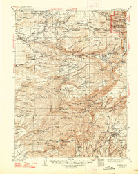
1941 Map of Mineral
USGS Topo · Published 1948About this map
Lassen Volcanic National Park and the sprawling Lassen National Forest dominate this landscape during the mid-1930s survey period. The transition from the Sacramento Valley floor into the high volcanic reaches is marked by early hydroelectric developments at Volta Power House and Inskip Power House. Settlers and surveyors have left a dense network of family-named landmarks and seasonal outposts across the terrain, including the Facht Homestead, Brockman Cabin, and Apperson Place.
Find a feature on this map
189 named features on this map. Tap any name to fly to it.
Don’t see what you’re looking for? This feature index may not catch every label — zoom into the map to look around manually.
Map Details
Editions of this 1941 Mineral Map
3 editions found

Other maps of this area

1886 · Lassen Peak
USGS Topo · 1:250,000

1888 · Bidwell Bar
USGS Topo · 1:125,000

1890 · Red Bluff
USGS Topo · 1:250,000

1891 · Bidwell Bar
USGS Topo · 1:125,000

1891 · Chico
USGS Topo · 1:125,000

1892 · Lassen Peak
USGS Topo · 1:250,000

1893 · Chico
USGS Topo · 1:125,000

1893 · Bidwell Bar
USGS Topo · 1:125,000

1894 · Lassen Peak
USGS Topo · 1:250,000

1894 · Red Bluff
USGS Topo · 1:250,000