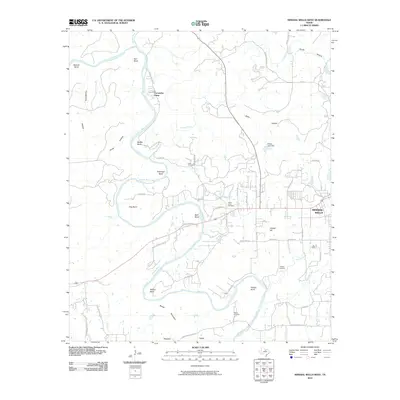
2010 Map of Mineral Wells West
USGS Topo · Published 2010About this map
The Brazos River creates a meandering path through Palo Pinto County, defining the local geography with a series of dramatic oxbows including Hart Bend, Moffitt Bend, and Hittson Bend. This 2010 topographic record shows the western outskirts of Mineral Wells as it transitions into the river valley terrain. The landscape is characterized by prominent elevations like Pollard Hill and Barber Mountain, interspersed with drainage features such as Keechi Creek and Turkey Creek.
Find a feature on this map
54 named features on this map. Tap any name to fly to it.
Don’t see what you’re looking for? This feature index may not catch every label — zoom into the map to look around manually.
Map Details
Editions of this 2010 Mineral Wells West Map
This is the sole edition of this map. No revisions or reprints were ever made.
Other maps of this area

1891 · Palo Pinto
USGS Topo · 1:125,000

1918 · Palo Pinto
USGS Topo · 1:125,000

1924 · Palo Pinto 2-a
USGS Topo · 1:48,000

1924 · Palo Pinto 1-b
USGS Topo · 1:48,000

1925 · Palo Pinto 4-b
USGS Topo · 1:48,000

1927 · Pickwick
USGS Topo · 1:62,500

1927 · Mineral Wells
USGS Topo · 1:62,500

1931 · Santo
USGS Topo · 1:62,500

1954 · Abilene
USGS Topo · 1:250,000

1958 · Abilene
USGS Topo · 1:250,000