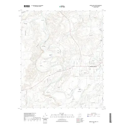
2019 Map of Mineral Wells West
USGS Topo · Published 2019About this map
The Brazos River winds in dramatic loops through this portion of Palo Pinto County, defining a landscape of sharp bends and deep hollows like Birdwell Hollow and Jones Hollow. The western outskirts of Mineral Wells dominate the eastern edge of the survey, where the residential grid gives way to more rugged terrain. This 2019 data release from the U.S. Geological Survey shows the transition from the developed city center to the rural valley, highlighting the persistent family names attached to the land. Genealogists will find several burial sites preserved among the hills, including Locke Cem near the river and Hittson Cem further south. The topography is marked by notable elevations such as Pollard Hill and Barber Mtn, while small aviation interests are represented by the Flying U Airport situated near the northern canyons.
Find a feature on this map
68 named features on this map. Tap any name to fly to it.
Don’t see what you’re looking for? This feature index may not catch every label — zoom into the map to look around manually.
Map Details
Editions of this 2019 Mineral Wells West Map
This is the sole edition of this map. No revisions or reprints were ever made.
Other maps of this area

1891 · Palo Pinto
USGS Topo · 1:125,000

1918 · Palo Pinto
USGS Topo · 1:125,000

1924 · Palo Pinto 2-a
USGS Topo · 1:48,000

1924 · Palo Pinto 1-b
USGS Topo · 1:48,000

1925 · Palo Pinto 4-b
USGS Topo · 1:48,000

1927 · Pickwick
USGS Topo · 1:62,500

1927 · Mineral Wells
USGS Topo · 1:62,500

1931 · Santo
USGS Topo · 1:62,500

1954 · Abilene
USGS Topo · 1:250,000

1958 · Abilene
USGS Topo · 1:250,000