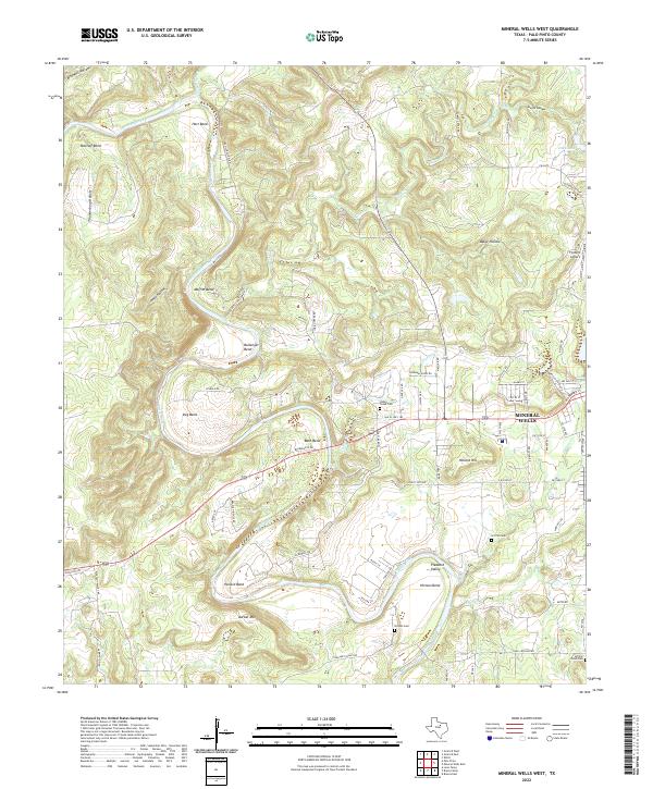
2022 Map of Mineral Wells West
USGS Topo · Published 2022About this map
The Brazos River creates a serpentine landscape of dramatic meanders and named bends across this Palo Pinto County terrain. These river loops, including Hart Bend, Ballenger Bend, and Hittson Bend, define the region's geography and history of settlement. To the east, the residential expansion of Mineral Wells reaches toward the river valley along W Hubbard St and Old US Hwy 180, while the rural surroundings maintain their character through family-named landmarks like Barber Mtn and Pollard Hill. Local genealogists will find several burial sites preserved across the landscape, such as Indian Creek Cem, Griffin Cem, and Willow Pond Cem. The map also documents the aviation history of the area with the Flying U Airport located north of the city limits.
Find a feature on this map
76 named features on this map. Tap any name to fly to it.
Don’t see what you’re looking for? This feature index may not catch every label — zoom into the map to look around manually.
Map Details
Editions of this 2022 Mineral Wells West Map
This is the sole edition of this map. No revisions or reprints were ever made.
Other maps of this area

1891 · Palo Pinto
USGS Topo · 1:125,000

1918 · Palo Pinto
USGS Topo · 1:125,000

1924 · Palo Pinto 2-a
USGS Topo · 1:48,000

1924 · Palo Pinto 1-b
USGS Topo · 1:48,000

1925 · Palo Pinto 4-b
USGS Topo · 1:48,000

1927 · Pickwick
USGS Topo · 1:62,500

1927 · Mineral Wells
USGS Topo · 1:62,500

1931 · Santo
USGS Topo · 1:62,500

1954 · Abilene
USGS Topo · 1:250,000

1958 · Abilene
USGS Topo · 1:250,000