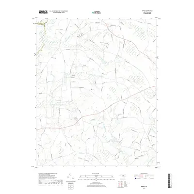
2019 Map of Mingo
USGS Topo · Published 2019About this map
Plain View and Mingo anchor this section of North Carolina's Coastal Plain, where the landscape is defined by an intricate network of wetlands and family homesteads. The topography is notably marked by the Beaverdam Dismal and numerous drainage systems like Starlins Swamp and Slumping Run, which reflect the historic challenges of managing water in this agricultural region. For genealogists, the map is a vital resource, identifying several specific family-named burial sites including Lee Cem, Naylor Cem, and Jackson Cem.
Find a feature on this map
111 named features on this map. Tap any name to fly to it.
Don’t see what you’re looking for? This feature index may not catch every label — zoom into the map to look around manually.
Map Details
Editions of this 2019 Mingo Map
This is the sole edition of this map. No revisions or reprints were ever made.
Other maps of this area

1906 · Four Oaks
USGS Topo · 1:48,000

1908 · Four Oaks
USGS Topo · 1:62,500

1909 · Coharie
USGS Topo · 1:62,500

1953 · Raleigh
USGS Topo · 1:250,000

1954 · Raleigh
USGS Topo · 1:250,000

1973 · Dunn
USGS Topo · 1:24,000

1973 · Erwin
USGS Topo · 1:24,000

1974 · Salemburg
USGS Topo · 1:24,000
1974 · Wade
USGS Topo · 1:24,000
1974 · Stedman
USGS Topo · 1:24,000