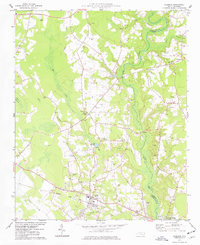
1974 Map of Stedman
USGS Topo · Published 1977About this map
The South River forms the natural boundary between Cumberland and Sampson counties, anchoring a landscape defined by its blackwater swamps and slow-moving tributaries in the mid-1970s. The settlement of Stedman serves as the local hub along the Seaboard Coast Line railroad, surrounded by rural communities like Bethany Crossroads and Clement. The terrain is marked by distinctive hydrological features such as Bruce Pocosin and the marshy expanses of Jones Swamp and Browns Swamp, which influenced the placement of early industry at Gaines Millpond and Maxwell Millpond.
Find a feature on this map
42 named features on this map. Tap any name to fly to it.
Don’t see what you’re looking for? This feature index may not catch every label — zoom into the map to look around manually.
Map Details
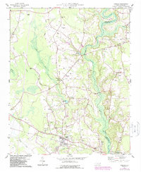
Editions of this 1974 Stedman Map
2 editions found
Other maps of this area

1948 · Fayetteville
USGS Topo · 1:62,500

1948 · Slocomb
USGS Topo · 1:24,000

1949 · Vander
USGS Topo · 1:24,000

1950 · Slocomb
USGS Topo · 1:24,000

1953 · Florence
USGS Topo · 1:250,000

1953 · Raleigh
USGS Topo · 1:250,000

1954 · Florence
USGS Topo · 1:250,000

1954 · Raleigh
USGS Topo · 1:250,000

1957 · Vander
USGS Topo · 1:24,000

1957 · Fayetteville
USGS Topo · 1:62,500