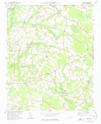
1974 Map of Mingo
USGS Topo · Published 1977About this map
Mingo and its surrounding wetlands define the rural character of this Sampson County landscape during the mid-1970s. The region is heavily marked by a complex drainage system, where the waters of Mingo Swamp, Beaverdam Swamp, and Williamson Swamp converge. This environment supported local industry and recreation, evidenced by the Tart Millpond and Williams Lake, the latter featuring a Lookout Tower on its eastern shore.
Find a feature on this map
45 named features on this map. Tap any name to fly to it.
Don’t see what you’re looking for? This feature index may not catch every label — zoom into the map to look around manually.
Map Details
Editions of this 1974 Mingo Map
This is the sole edition of this map. No revisions or reprints were ever made.
Other maps of this area

1906 · Four Oaks
USGS Topo · 1:48,000

1908 · Four Oaks
USGS Topo · 1:62,500

1909 · Coharie
USGS Topo · 1:62,500

1953 · Raleigh
USGS Topo · 1:250,000

1954 · Raleigh
USGS Topo · 1:250,000

1973 · Dunn
USGS Topo · 1:24,000

1973 · Erwin
USGS Topo · 1:24,000

1974 · Salemburg
USGS Topo · 1:24,000
1974 · Wade
USGS Topo · 1:24,000
1974 · Stedman
USGS Topo · 1:24,000