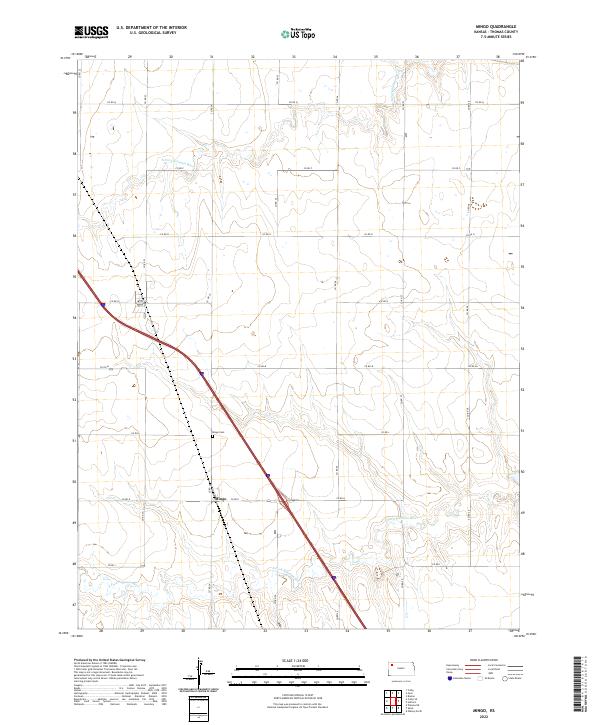
2022 Map of Mingo
USGS Topo · Published 2022About this map
Mingo is the central settlement in this portion of the High Plains, situated at the junction of several county routes and a modern highway corridor. The landscape is defined by the headwaters of the N Fork Solomon River and the S Fork Solomon River, which carve distinct drainage patterns across the prairie. The community's history is anchored by the Mingo Cem, a primary genealogical landmark for Thomas County researchers. Most of the terrain is organized by a rigid grid of local roads, including Co RD 22, Co RD Q, and Co RD 24, which delineate the expansive agricultural sections of t8s r33w and surrounding townships. This 2022 edition provides a clear view of the rural infrastructure and the persistent natural watercourses that have shaped this Kansas landscape for generations.
Find a feature on this map
23 named features on this map. Tap any name to fly to it.
Don’t see what you’re looking for? This feature index may not catch every label — zoom into the map to look around manually.
Map Details
Editions of this 2022 Mingo Map
This is the sole edition of this map. No revisions or reprints were ever made.
Other maps of this area

1943 · Colby
USGS Topo · 1:62,500

1954 · Goodland
USGS Topo · 1:250,000

1956 · Goodland
USGS Topo · 1:250,000

1957 · Goodland
USGS Topo · 1:250,000

1967 · Colby SE
USGS Topo · 1:24,000

1967 · Colby
USGS Topo · 1:24,000

1972 · Winona NE
USGS Topo · 1:24,000
1979 · Mingo
USGS Topo · 1:24,000

1979 · Oakley North
USGS Topo · 1:24,000
1979 · Gem
USGS Topo · 1:24,000