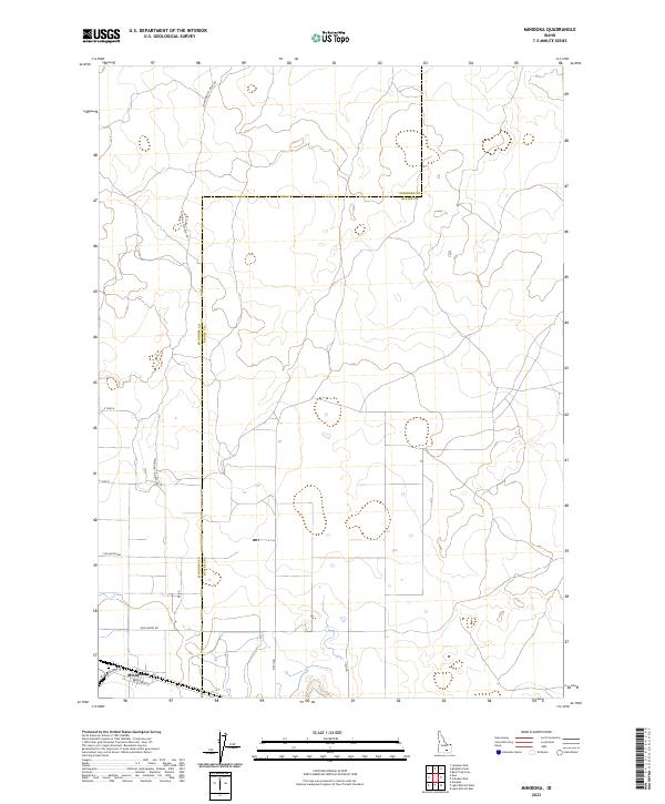
2023 Map of Minidoka
USGS Topo · Published 2023About this map
Minidoka serves as the primary hub of this high desert landscape, positioned along the southern edge of the quadrangle. The settlement's street grid, including Broadway St and Cherry St, anchors a region defined by a sparse but vital transportation network. The Minidoka Co Blaine Co boundary bisects the map, illustrating the administrative divisions of this expansive Snake River Plain environment. Northward, the land is traversed by the long-distance Minidoka To Arco Rd, which cuts through a series of townships and ranges. This network of section lines and secondary routes like Yale Rd and 1100 North Rd suggests a landscape organized for agricultural and ranching utility, where roads provide the primary structure across the open Idaho terrain.
Find a feature on this map
17 named features on this map. Tap any name to fly to it.
Don’t see what you’re looking for? This feature index may not catch every label — zoom into the map to look around manually.
Map Details
Editions of this 2023 Minidoka Map
This is the sole edition of this map. No revisions or reprints were ever made.
Other maps of this area

1954 · Pocatello
USGS Topo · 1:250,000

1958 · Pocatello
USGS Topo · 1:250,000

1959 · Lake Walcott
USGS Topo · 1:62,500

1964 · Acequia
USGS Topo · 1:24,000

1972 · Schodde Well
USGS Topo · 1:24,000

1972 · Bear Trap Cave
USGS Topo · 1:24,000

1972 · Minidoka
USGS Topo · 1:24,000

1972 · Max
USGS Topo · 1:24,000
1972 · Brigham Point
USGS Topo · 1:24,000
1972 · Larkspur Park
USGS Topo · 1:24,000