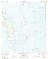
1957 Map of Mink Bayou
USGS Topo · Published 1980About this map
Bayou Lafourche anchors this coastal landscape, where the intrusion of the energy industry into the Louisiana wetlands is clearly visible through a network of canals and infrastructure. The map reveals an active Oil Field populated with Oil Tanks and industrial structures that contrast with the surrounding marshland. These wetlands are defined by a complex hydrology of tidal waters such as Bay Jaque, Bay Rambo, and Mink Bayou, alongside larger bodies like North Lake and Lake Jesse.
Find a feature on this map
24 named features on this map. Tap any name to fly to it.
Don’t see what you’re looking for? This feature index may not catch every label — zoom into the map to look around manually.
Map Details
Editions of this 1957 Mink Bayou Map
3 editions found
Other maps of this area

1892 · Cheniere Caminada
USGS Topo · 1:62,500

1892 · Creole
USGS Topo · 1:62,500

1894 · Timbalier
USGS Topo · 1:62,500

1894 · Lake Felicity
USGS Topo · 1:62,500

1935 · Bay Courant
USGS Topo · 1:31,680

1935 · Golden Meadow
USGS Topo · 1:31,680

1935 · Pelican Pass
USGS Topo · 1:31,680

1935 · Mink Bayou
USGS Topo · 1:31,680

1935 · Leeville
USGS Topo · 1:31,680

1939 · Lake Felicity
USGS Topo · 1:62,500