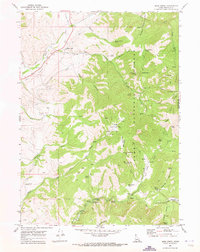
1969 Map of Mink Creek
USGS Topo · Published 1973About this map
The settlement of Mink Creek serves as a small hub in this Idaho landscape, which transitions from river-bottom ranch land into the high elevations of the Cache National Forest. The map documents a complex water-management system essential to this high-altitude environment, featuring a Flume, a Siphon, and the Station Creek Tunnel. These features, alongside the Gaging Station on the Cub River, illustrate the infrastructure required to manage mountain runoff for local use.
Find a feature on this map
54 named features on this map. Tap any name to fly to it.
Don’t see what you’re looking for? This feature index may not catch every label — zoom into the map to look around manually.
Map Details
Editions of this 1969 Mink Creek Map
2 editions found
Other maps of this area

1915 · Preston
USGS Topo · 1:96,000

1918 · Preston
USGS Topo · 1:125,000

1955 · Preston
USGS Topo · 1:250,000

1958 · Preston
USGS Topo · 1:250,000

1962 · Preston
USGS Topo · 1:250,000
1969 · Midnight Mtn
USGS Topo · 1:24,000
1969 · Egan Basin
USGS Topo · 1:24,000
1969 · Treasureton
USGS Topo · 1:24,000
1969 · Paris Peak
USGS Topo · 1:24,000
1969 · Franklin
USGS Topo · 1:24,000