
1965 Map of Minneapolis North
USGS Topo · Published 1966About this map
Minneapolis serves as the primary hub on this mid-1960s survey, situated where the Atchison Topeka and Santa Fe and Union Pacific railroads intersect. The landscape is defined by the sinuous path of the Solomon River as it meanders through townships like Garfield and Center, creating a complex floodplain of oxbows and river bends. Small rural social centers are visible in the surrounding hills, including the Hall Ch in the northeast and the Highway View Sch located in Blaine township.
Find a feature on this map
25 named features on this map. Tap any name to fly to it.
Don’t see what you’re looking for? This feature index may not catch every label — zoom into the map to look around manually.
Map Details
Editions of this 1965 Minneapolis North Map
This is the sole edition of this map. No revisions or reprints were ever made.
Other maps of this area

1892 · Minneapolis
USGS Topo · 1:125,000

1952 · Glasco
USGS Topo · 1:24,000

1955 · Manhattan
USGS Topo · 1:250,000

1956 · Manhattan
USGS Topo · 1:250,000

1957 · Manhattan
USGS Topo · 1:250,000

1961 · Tescott NE
USGS Topo · 1:24,000

1964 · Lamar
USGS Topo · 1:24,000
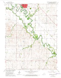
1965 · Minneapolis South
USGS Topo · 1:24,000
1965 · Aurora SW
USGS Topo · 1:24,000
1965 · Wells
USGS Topo · 1:24,000