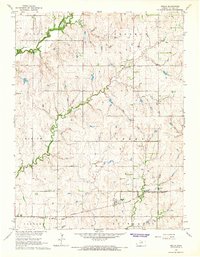
1965 Map of Wells
USGS Topo · Published 1966About this map
The unincorporated community of Wells serves as the focal point for this mid-1960s survey of north-central Kansas. Situated along the Atchison Topeka and Santa Fe railway, the area is defined by its agrarian character and the winding courses of Middle Pipe Creek, Pipe Creek, and Lindsey Creek. These waterways traverse several township-sized divisions, including Logan, Sherman, Blaine, Grant, Concord, and Richland.
Find a feature on this map
13 named features on this map. Tap any name to fly to it.
Don’t see what you’re looking for? This feature index may not catch every label — zoom into the map to look around manually.
Map Details
Editions of this 1965 Wells Map
This is the sole edition of this map. No revisions or reprints were ever made.
Other maps of this area

1891 · Clay Center
USGS Topo · 1:125,000

1892 · Minneapolis
USGS Topo · 1:125,000

1955 · Manhattan
USGS Topo · 1:250,000

1956 · Manhattan
USGS Topo · 1:250,000

1957 · Manhattan
USGS Topo · 1:250,000

1964 · Lamar
USGS Topo · 1:24,000

1964 · Miltonvale
USGS Topo · 1:24,000
1965 · Minneapolis South
USGS Topo · 1:24,000
1965 · Manchester NW
USGS Topo · 1:24,000

1965 · Minneapolis North
USGS Topo · 1:24,000