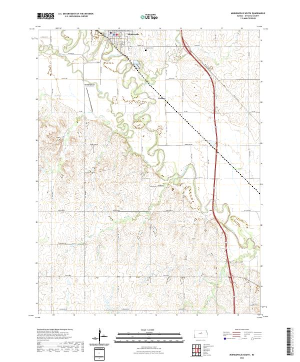
2022 Map of Minneapolis South
USGS Topo · Published 2022About this map
Minneapolis serves as the focal point of this 2022 survey, with the Ottawa County Courthouse anchoring the town center near the banks of the Solomon River. The river's winding course dictates much of the local geography, joined by tributaries like Salt Cr and Lindsey Cr. Just south of the main settlement lies Lindsey, a smaller community situated along the western edge of the river valley. The landscape is marked by a transition from the river bottomlands to higher ground, where the Minneapolis City County Airport and Highland Cem are established. A dense grid of rural roads, such as Coronado RD and Frontier RD, divide the surrounding agricultural lands, reflecting the enduring legacy of the Public Land Survey System in this part of Kansas.
Find a feature on this map
29 named features on this map. Tap any name to fly to it.
Don’t see what you’re looking for? This feature index may not catch every label — zoom into the map to look around manually.
Map Details
Editions of this 2022 Minneapolis South Map
This is the sole edition of this map. No revisions or reprints were ever made.
Other maps of this area

1892 · Salina
USGS Topo · 1:125,000

1892 · Minneapolis
USGS Topo · 1:125,000

1942 · Salina
USGS Topo · 1:125,000

1955 · Trenton
USGS Topo · 1:24,000

1955 · Culver
USGS Topo · 1:24,000

1955 · New Cambria
USGS Topo · 1:24,000

1955 · Manhattan
USGS Topo · 1:250,000

1955 · Hutchinson
USGS Topo · 1:250,000

1956 · Manhattan
USGS Topo · 1:250,000

1957 · Manhattan
USGS Topo · 1:250,000