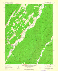
1962 Map of Minnehaha Springs
USGS Topo · Published 1963About this map
Minnehaha Springs serves as a central point of settlement in this 1962 topographical study, where the borders of the Monongahela National Forest and George Washington National Forest converge along the state line of West Virginia and Virginia. The landscape is defined by the significant corridor of Knapp Creek, which cuts through the ridge systems of Browns Mountain and Lockridge Mountain. A distinct aviation presence is noted at Dourif Airport, while local recreational history is preserved at Camp Minnehaha.
Find a feature on this map
80 named features on this map. Tap any name to fly to it.
Don’t see what you’re looking for? This feature index may not catch every label — zoom into the map to look around manually.
Map Details
Editions of this 1962 Minnehaha Springs Map
3 editions found
Other maps of this area

1891 · Huntersville
USGS Topo · 1:125,000

1894 · Huntersville
USGS Topo · 1:125,000

1901 · Monterey
USGS Topo · 1:125,000

1922 · Cass
USGS Topo · 1:48,000

1923 · Marlinton
USGS Topo · 1:48,000

1923 · Warm Springs
USGS Topo · 1:48,000

1923 · Mingo
USGS Topo · 1:48,000

1924 · Cass
USGS Topo · 1:62,500

1925 · Mingo
USGS Topo · 1:62,500

1925 · Marlinton
USGS Topo · 1:62,500